
On February 15, 2025, the Fisters Team chased a strong tornado threat in the Southeastern US. The tornado threat never materialized, but a damaging wind threat did. Here’s the discussion as to why this occurred.
Synopsis
A deep upper-level trough traversed the United States, serving as the synoptic-scale driver of this severe weather event. This system was supported by a strong low-level jet, abundant moisture, and warm temperatures in the Southeast. To understand why tornadoes were limited despite a seemingly favorable environment, we must analyze the vertical atmospheric structure.
Upper Air Analyses
300mb


At 300mb (~30,000 feet), you can see our deep upper level trough moving across the US as well as changing its tilt. For a little background, a positively tilted trough is oriented southwest to northeast, a neutral tilt is north to south, and a negatively tilted trough is northwest to southeast. As you can see in the loop below, this trough started out positively tilted, and these are not typically severe weather producers. Not to say it doesn’t happen, it just is not as common. It then transitions to a more neutral tilt when it reaches the middle of the country, which produces severe weather but are not typically associated with outbreaks. Finally, as it reaches the Southeast, it takes on a more negative tilt, which are notorious for producing our larger severe weather events. The reason the trough in our case takes on a negative tilt is because of the very strong jet streak in front of it and the relatively weaker winds behind it. We also need to look at the timing of this trough, it was pretty well oriented with our severe threat. Also, we look at what is called Four Quadrant Jet Theory. This theory helps us to understand if there will be synoptic scale rising or sinking motion. In this case, we were within the right entrance region for the duration of this event, which means there was upper level divergence, or rising air. Which is really good for storm development.
500mb

Descending to 500mb (~20,000 feet), we can see that there is a shortwave trough moving over the region that becomes less noticeable as it moves further to the east. But, it is still there and was another source for the forecasted severe weather in the Southeast. You can also see in the wind barbs that friction still was not playing a role in the jet at that time because there is still a potent upper level jet, even at 500mb. Which is roughly 6 kilometers or 20,000 feet. You can also begin to see the cut-off low pressure system that is connected to our larger trough at 300mb, it is sitting in southern Canada, in Manitoba.
700mb

At 700mb, we can still see our shortwave trough, as well as some moist air moving into the region Saturday into Sunday. This moisture allowed for our storm to be deeper than just a typical pop-up thunderstorm since there was more moisture further into the atmosphere.
850mb

At 850mb, we can see our surface low pressure system become closed off. We also see a low-level jet (LLJ) that is aiding in the wind shear available for storms to use in order to start rotating. A strong LLJ is one of the most important ingredients for severe weather because not only does it bring in shear, it’s bringing in warm, moist air from the Gulf.
925mb

Looking almost at the surface at 925mb, we can see our warm, moist air being transported in from the Gulf along with the warm front. We also see the cold front moving from west to east across the US. There was surface convergence that was able to push storms up to the Level of Free Convection (LFC) and that is how we were able to get storms to form along that boundary. The LFC is the point in the atmosphere where the air parcels no longer need any help to rise, so they rise freely. We also see the surface low tracking across the US and near the Southeast, This aided in creating more wind shear to help storms rotate.
With upper-level support in place, we now turn to the surface features, which played a crucial role in storm development.
Surface Analysis

The surface low that was associated with the severe weather outbreak in the Southeast originated in the Panhandle region of Texas/Oklahoma. You can see the warm front rapidly lifting north on Saturday as well as the cold front advancing eastward Saturday into Sunday. The cold front and warm front were both focal points of severe storms because of the convergence at the surface, lifting air parcels, thus making updrafts that eventually became storms.
Mesoanalysis
Surface Based CAPE

CAPE stands for Convective Available Potential Energy, which is basically just fuel for storms. On Saturday, the CAPE values were up to 2000 to 3000 J/kg. Which, in the winter, is a very significant amount. To put that into perspective, in the winter across the Southeast, 500-1000 J/kg is all you really need for severe storms, and when you throw in wind shear, that is plenty for tornadoes. So this was setting up to be a really big day across Mississippi and Central/Northern Alabama. With such a significant amount of CAPE across the region, which was above what most of the models had shown for days leading up to the event, the Fisters team as well as the National Weather Service (NWS) were growing concerned with the potential for several strong, long-tracked tornadoes.
Bulk Shear

The next piece of the puzzle is wind shear, and one measure of shear is bulk shear. Which is important for storm organization, mesocyclone, and tornado development. Wind shear is the change of wind speed and direction as you increase in height. Bulk shear values were not super crazy, but definitely enough to produce several tornadoes that day. Surface-1km bulk shear that day was between 30 and 40 knots over the entirety of Mississippi, which is indicative of tornado development since we are looking in the lowest levels of the atmosphere.

Moving on to surface-3km bulk shear, which is important for storm mode as well as storm organization, we were looking at values of 40-50 knots which indicates organized convection and possibly even some supercells ahead of the Quasi-Linear Convective System (QLCS) that swept through that night. QLCS is more or less a fancy term in the meteorology world that means a line of storms.

There is one more parameter of bulk shear that I would like to talk about, and that is effective bulk shear. So this is just bulk shear values that are in the inflow of a storm that will have the most effect on it. The effective bulk shear that day was 40-50 knots, which is really good given the time of year. Seeing bulk shear values like these are typically telling you to get ready for a long day of tornadoes, but that didn’t happen. To understand why, we still need to go over more parameters.
Storm Relative Helicity

The next parameter I want to discuss is Storm Relative Helicity (SRH). This is a measure of the potential for cyclonic updraft rotation in a thunderstorm. It quantifies the amount of streamwise vorticity that a storm can ingest, which influences the likelihood of mesocyclone development and tornado formation. In other words, how much spin is in the atmosphere that a storm can ingest and begin to rotate. First, let’s look at Surface-1km SRH, we were seeing values in the 200-300 m2/s2 range. Which are definitely high enough to get several rotating storms.

Moving to the Surface-3km SRH, we were seeing values in the 300-400 m2/s2 range. Which is indicative that there is potential for a few strong tornadoes and numerous weaker tornadoes.

Looking at Surface-500m SRH, which is a new product by the NWS Storm Prediction Center on their Mesoanalysis page, we were seeing values in the 100-200 m2/s2 range. Which is pretty high for such a low level.
Lapse Rates

The final parameter that we are going to look at are lapse rates. Lapse rates are the rate at which an air parcel cools as it rises in the atmosphere. They are very helpful in forecasting for strong winds, hail, and atmospheric stability. The steeper the lapse rate, the more unstable the atmosphere is and the faster the air parcel will rise. So, looking at the low-level lapse rate (LLLR), we see it is around 6°-7°C/km. Which is fairly steep and is indicative of an unstable atmosphere.

Mid-level lapse rates were in the 6°-6.5° range. Which tells us that there was potential for some hail as well as organized storms and convective initiation.
Severe Weather Parameters vs. Observed Outcomes
| Parameter | Tornado Favorability | Observed Impact |
| CAPE (J/kg) | 2000-3000 (Very Favorable) | No sustained convection |
| Bulk Shear (knots) | 40-50 (Tornado Potential) | Storms remained linear |
| SRH (m²/s²) | 200-400 (Supercells Likely) | Pre-frontal storms struggled |
| Lapse Rates (°C/km) | 6-7 (Unstable) | Dry air prevented updrafts |
Radar

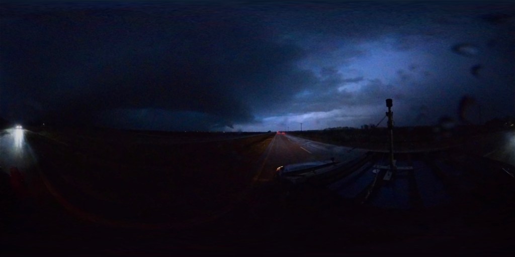
Now, looking at our radar imagery, we can start to see how things evolved throughout the day. We started off with a few showers that morning along the warm front where there was enough forcing to allow for shallow convection to occur. They quickly lifted off to the north with the front and died off. Around 21z, or 3pm local time, we see some storms firing along the cold front as it advanced to the east. There were some pop-up showers in the open warm sector that started by late morning into early afternoon but nothing could sustain itself. Given the environment that the team was seeing on the SPC Mesoanalysis page, we really just couldn’t understand why the storms couldn’t keep going. We assumed that it was due to strong shear and they were weak updrafts so they weren’t able to overcome it. We continued to wait patiently for discrete supercells to form, but on the radar loop, you see that never happens. As the line of storms along the cold front began to encroach on the Mississippi River, we noticed a few storms that were able to begin sustaining themselves to our south, just to the east of Greenville, MS. We were in Clarksdale, MS and began to dive south ahead of the storms. It quickly became apparent that they were going to be rain-wrapped and we wouldn’t be able to see anything easily, so we waited for the storms to get closer and waited in Leland, MS for them to come to us. Those storms eventually began to die as they crossed the river and their inflows were impeded by rain-cooled air being sent out from the approaching QLCS.
Satellite

Looking at the satellite, we see that clouds were clearing out very quickly, something that models did not anticipate. This was yet another precursor that we would be dealing with a significant event. As the clouds began to clear from south to north, we noticed that there were horizontal convective rolls (HCRs), also known as cloud streets, that had formed from East Texas all the way to at least Central Mississippi. HCRs are great for convective initiation (CI) because that means there is low level convergence and they have the potential to spark supercells. The Fisters team usually keeps an eye out for these as they are a great sign for storms to form.

Now, let’s take a look at the Long Wave Infrared satellite. What we are looking for on this product is colder cloud tops, because that is representative of taller storms, and therefore stronger storms. We can see that there was some convection that tried to fire up along the HCRs, but it could not sustain itself. However, the QLCS was very tall, which contributed to the strong winds that made it to the surface.
Key Factors That Prevented Tornado Development

Despite the impressive setup, the day did not deliver the expected tornado outbreak. To understand why, we need to examine the atmospheric soundings in greater detail. Well, to find out that answer, we have to go above the surface and the best way to visualize that is by looking at the soundings from Jackson, MS. They are the most representative of what the Fisters team was chasing in. First, let’s take a look at that 00z (6pm) Friday, February 14th. We can see that at the surface, it was 61° with a dew point of 37°, which is very dry for the Southeast. There was already some substantial wind shear in place, but there was nothing to make storms form. Which makes sense because this was as the sun was setting the night before the event.

Now, we are going to take a look at the 12z (6am) Saturday, February 15th sounding from Jackson, MS. We can see that now our temperature at the surface is 63° with a dew point of 61°, we were finally saturated at the surface. This was caused by the early morning precipitation that moved through. However, we could see that the environment was getting better. Take note of the layer of dry air between 700mb and 500mb, that will be important later.

Let’s move a little further into the afternoon. We are now at 20z (2pm) on Saturday, the surface has become a little drier with a temperature of 79° and a dew point of 64°. We note that the wind is from the due south, which is also important to note. Winds from the southeast are more favorable for tornado development because they enhance SRH, low-level wind shear, bring in more moisture, and stronger inflow into storms. You can also see that the lapse rate is higher than the previous 2 soundings, which means we are growing more supportive of supercell development. However, you see the dry air start to mix down with the boundary layer, which is why convection was forming but not able to sustain itself.

By 00z (6pm) Saturday, that warm, dry air had mixed down and created an inversion at 700mb. Which means that storms needed more forcing to punch through it and reach the LFC in order to become sustained. Which didn’t happen until the QLCS was closer and the cold pool was able to lift the storm through that inversion. We note an increase in the SRH, but still no storms. Our surface wind was still out of the due south as well.

Finally, we look at 04z (10pm) as the QLCS was moving through the Jackson area. We see that the dry air has been handled by the QLCS and the sounding is almost completely saturated except for a little dry air around 500mb. We also note a huge increase in SRH, which is likely due to the fact that our surface wind is now SSE, which was feeding directly into the QLCS and enhancing low-level rotation. This is why we experienced so many QLCS spin-up tornadoes instead of supercells. The dry air and inversion aloft was too much for the pre-frontal convection to break through and we never got any supercells.

Now, the straight-line winds were the main story with this line. This is because the temperature followed the moist adiabat pretty much the entire way down through the sounding, which allowed for the stronger winds aloft to be mixed down to the surface, making this QLCS a prolific severe wind event.

Leave a comment