

On March 15, 2025, the Fisters Team chased a strong tornado threat in the Southeastern US. This tornado threat did not live up to its fullest potential. In this meteorological discussion, we will find out why.
Synopsis
An outbreak of severe weather, including large hail, damaging winds, as well as numerous strong to violent, long-tracked tornadoes were on the table. However, there were only a few long-tracked, violent tornadoes with a lot of short-lived, relatively weaker tornadoes.
Upper Air Analyses
300mb


At 300mb (~30,000 feet), we see an upper-level cut-off low centered near the intersection of Nebraska, Kansas, Missouri, and Iowa. This cut-off low is moving northeastward, promoting a broader upper-level flow across the central US. Extending from southern Saskatchewan and Manitoba into southern Texas is a well-defined longwave trough. This trough is negatively tilted, which is enhancing upper-level divergence which is a necessary ingredient for storms to initiate. Within the longwave, we see several shortwave troughs. The one that we are most interested in is the shortwave over the Plains, which is providing additional large-scale ascent. Additionally, a strong jet streak can be seen rounding the base of the longwave and moving northward. This places the Deep South in the right entrance region, which is a region of additional upper-level divergence and aids in large-scale ascent.
Let’s continue our analysis at 500mb.
500mb

Descending to 500mb (~20,000 feet), we can still see our cut-off low over the central Plains. The longwave trough is still present, with several shortwave perturbations present. There is one that extends from the Bootheel of Missouri to southeast Alabama that is contributing to enhanced lift over the Deep South. There is another shortwave present on the west side of the main longwave, however that is not influencing the High Risk area. Overall, the 500mb pattern strongly favors severe weather.
Let’s keep moving through the atmosphere down to 700mb.
700mb

At 700mb (~10,000 feet), strong mid-level dynamics helped reinforce the potential for severe convection throughout the March 15–16 event. A well-defined mid-level low over the central U.S. was accompanied by increasing moisture and temperature advection across the Southeast. This contributed to deep-layer ascent and maintained mid-level instability. As the system matured, a classic dry slot wrapped into the backside of the trough, enhancing storm structure and potential downdraft strength. Widespread mid-level moisture in the warm sector combined with strong southwesterly flow to maintain a favorable environment for supercells and organized convection.
Let’s get even closer to the surface at 850mb.
850mb

At 850mb (~5,000 feet), a strong low-level jet developed across the Deep South ahead of the approaching trough. Beginning late on March 15th and peaking early on the 16th, southerly winds between 40 and 50 knots transported rich Gulf moisture northward into the High Risk area. This led to a rapid increase in low-level dew points and warm air advection. All of these are key ingredients for building instability. Additionally, the veering wind profile with height created significant directional shear, enhancing the potential for rotating updrafts. By 00Z on March 16, a corridor of focused low-level convergence and strong inflow was in place from Mississippi through Alabama and into Tennessee. This coincided with increasing upper-level support and further reinforcing the risk for widespread severe weather and tornadoes.
925mb

At the 925mb level (~2,500 feet), strong southerly flow and robust moisture return from the Gulf played a critical role in setting the stage for tornadic supercells. Dew points above 18°C pushed well inland into the Southeast U.S., establishing a deeply saturated boundary layer. The warm sector expanded and sharpened over time, with increasing frictional convergence and low-level veering of winds. By the evening of March 15 and into March 16, strong low-level shear and a rich thermodynamic environment supported the development of rotating updrafts. Which enhanced the risk for significant tornadoes across parts of Mississippi, Alabama, and Georgia.
With these upper-level features in place, let’s turn to the surface and middle atmosphere to see what was happening.
Surface Analysis

There is a lot going on in these images, so let’s break it down. We see a surface low over the central Plains along with several cold fronts. The lead cold front is the one that is causing additional forcing across the region, and it eventually caused a QLCS across the region. A surface low also formed over the ArkLaMiss region which enhanced low-level wind shear and low-level moisture.
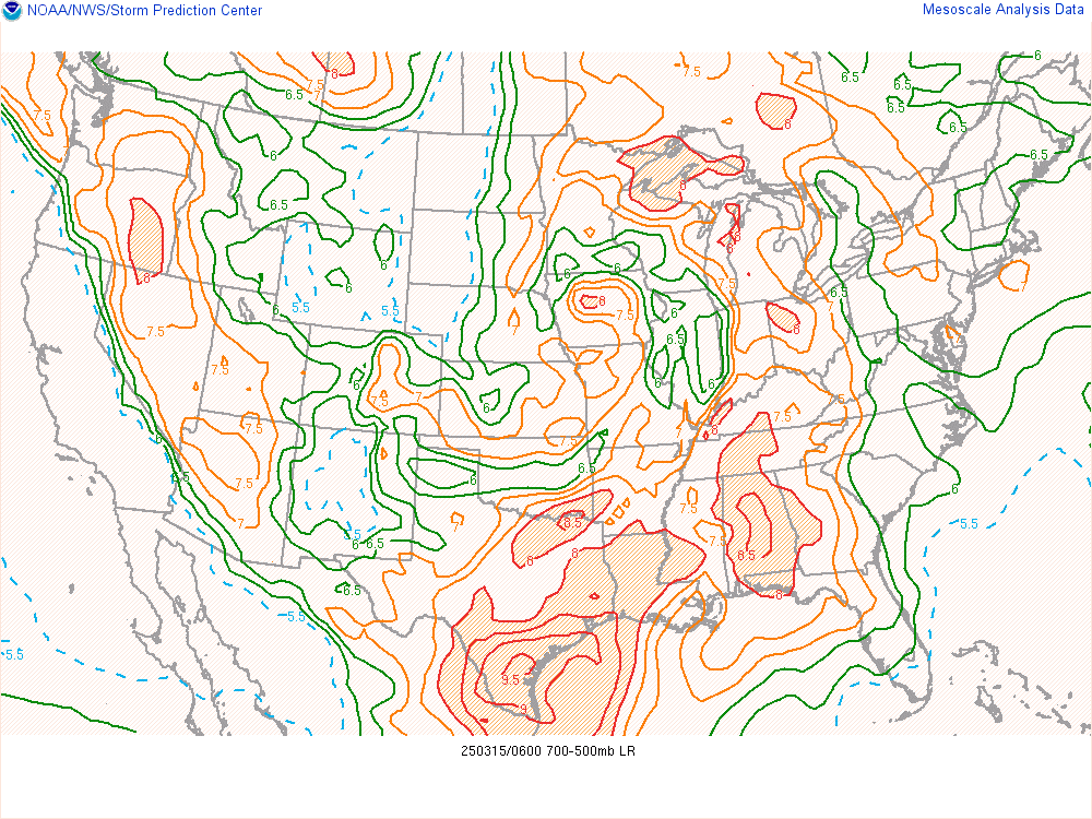
Mesoanalysis
Surface Based CAPE

CAPE stands for Convective Available Potential Energy, which, in layman’s terms, is fuel for storms. On Saturday, the CAPE values were 2500-3000J/kg. Which is a lot of fuel for the southeast in early March. So, the storm had plenty of fuel to sustain themselves, let’s see some other factors lined up for this event.
Bulk Shear

Bulk shear values were generally 30-40kts, however there were locally values up to 50kts. This is not a ton of bulk shear, but it is certainly enough for rotating storms. Especially in the lowest kilometer of the atmosphere. So these values are conducive for supercells.

Moving on to surface-3km bulk shear, which is important for storm mode as well as storm organization, we were looking at values of 45-55kts. The shear vectors were also semi-perpendicular to the boundaries, which means that we should expect discrete supercells. These shear values and shear vectors are favorable for discrete supercells forming over the Deep South.

The effective bulk shear was 60-70kts with values reaching 80kts in Northern Mississippi! Had we seen discrete supercells over the northern third of Mississippi, they would have likely caused some strong to violent tornadoes. But, with effective bulk shear values of generally 60-70kts, there is no question as to why we saw a couple strong to violent tornadoes in southern Mississippi.
Storm Relative Helicity

The next parameter I want to discuss is Storm Relative Helicity (SRH). This is a measure of the potential for cyclonic updraft rotation in a thunderstorm. It quantifies the amount of streamwise vorticity that a storm can ingest, which influences the likelihood of mesocyclone development and tornado formation. In other words, how much spin is in the atmosphere that a storm can ingest and begin to rotate. First, let’s look at Surface-1km SRH, we were seeing values in the 400-500m2/s2 range. Which is definitely conducive to rotating updrafts and tornadoes. The lowest 1km or so of the atmosphere is most important for tornadogensis to occur.

Moving to Surface-3km SRH, we were seeing values in the 500-600m2/s2 range. This is more than enough to get updrafts rotating and produce tornadoes. If you notice, as we get later in the GIF, these values get higher. This is because of the nocturnal low-level jet that ramped up after the sun went down. This is definitely the cause of the tornadoes that touched down in central and eastern Alabama after the sun went down.

Looking at Surface-500m SRH, which is a new product by the NWS Storm Prediction Center on their Mesoanalysis page, we were seeing values of 200-300m2/s2. We also see these values ramp up after dark, this is due to the nocturnal low-level jet as well. When we see values that high in that short of a layer, that certainly raises red flags in a meteorologist’s head that there will likely be tornadoes if storms are ongoing, or forming in the area.
Lapse Rates

The final parameter that we are going to look at are lapse rates. Lapse rates are the rate at which an air parcel cools as it rises in the atmosphere. They are very helpful in forecasting for strong winds, hail, and atmospheric stability. The steeper the lapse rate, the more unstable the atmosphere is and the faster the air parcel will rise. So, looking at the low-level lapse rate (LLLR), we see it is around 6°-7°C/km. Which is not wonderful for severe weather, but will definitely get the job done. Typically, we are looking for lapse rates in the 7°-8°C/km range.
Mid-level lapse rates were in the 6°-6.5°C/km range. Which tells us that there was potential for some hail as well as organized storms and convective initiation. While these are still pretty meager, they were able to produce dozens of tornadoes over the duration of the event.
| Parameter | Tornado Favorability | Observed Impact |
| CAPE (J/kg) | 2500-3000 (Very Favorable) | Sustained convection, grew upscale quickly |
| Bulk Shear (knots) | 60-70 (Tornado Potential) | Dozen of tornadoes associated with organized convection |
| SRH (m²/s²) | 400-500 (Supercells Likely) | Supercells did form |
| Lapse Rates (°C/km) | 6-7 (Unstable) | Airmass was extremely unstable |
Radar

Now, looking at our radar imagery, we can start to see how things evolved throughout the day. As we started the day, we could see a large precipitation shield over the northern third of Alabama. This widespread rain and cloud cover acted to limit surface heating and instability, ultimately hindering severe convection in that region. You can also see areas of convergence at the surface sparking convection in Louisiana and Mississippi. These are known as confluence bands, and are something that meteorologists look for to see where convective initiation may take place that day. While we saw these confluence bands that morning, the team decided to take a more northward play as we wanted to provide time for storms to mature. However, that did not work out in our favor. But, it did serve as a learning experience for the whole team. Anyways, let us continue. We see lots of discrete supercells forming by the early afternoon, 3 of which went on to produce strong to violent, long-track tornadoes in southern Mississippi. The fisters team did not adjust to this change as we thought they would continue to produce for quite some time. Luckily for the residents of the Deep South, this was not the case. As the day turned into night, the storms mostly congealed into a QLCS while there were a few discrete cells that formed throughout the night that went on to produce tornadoes across Alabama.
Satellite

Looking at the true color satellite imagery, we see that cloud cover dominated much of the risk area. This ultimately hindered what could’ve been a very bad day. While this was still a substantial tornado outbreak for the Deep South and the Southeast, it did not live up to its full potential regarding strong to violent tornadoes.

Now, let’s take a look at the Long Wave Infrared satellite. What we are looking for on this product is colder cloud tops, because that is representative of taller storms, and therefore stronger storms. Across the risk area, there was a lot of deep convection that occurred. That is why we saw so many tornadoes and even the few strong to violent tornadoes. Unfortunately, we can’t see the supercells that produced those tornadoes because the satellite archive did not have any images during that timeframe.
SPC Outlooks and Verification

This shows the evolution of the risk area. The SPC had very high confidence in a widespread tornado outbreak across the region. Their forecast actually verified for the number of tornadoes, just not their expected intensity, thankfully.


Soundings from New Orleans and Birmingham

Here are the soundings from Birmingham. We can see backed winds, winds from the southeast, at the surface which helps to further enhance low-level wind shear. There was also a capping inversion for much of the day, until the QLCS arrived and produced a couple of discrete cells as well as embedded supercells.

Here are the soundings from New Orleans. We can also see backed winds and a capping inversion here. The extremely backed winds beneath stronger southwesterly flow aloft as well as the cap contributed to strong low-level directional shear and convective inhibition, critical ingredients for rotating updrafts and tornado potential.
Key Failure Modes
So, what happened to prevent this outbreak from reaching its full potential? First, all of the upper-level, mid-level, and low-level data pointed to a prolific tornado outbreak. What kept this event at bay to north was rainfall and cloud cover that overspread much of the northern risk area. As far as the southern half is concerned, we believe that a lack of residual outflow boundaries that would have produced more widespread discrete convection as well as deviant right motion in supercells to enhance tornado potential. This led to storms growing upscale very quickly and widely hindered the strong to violent tornado threat. The team, while disappointed that we were only able to see one tornado, are extremely grateful that widespread destruction did not occur.

Leave a comment